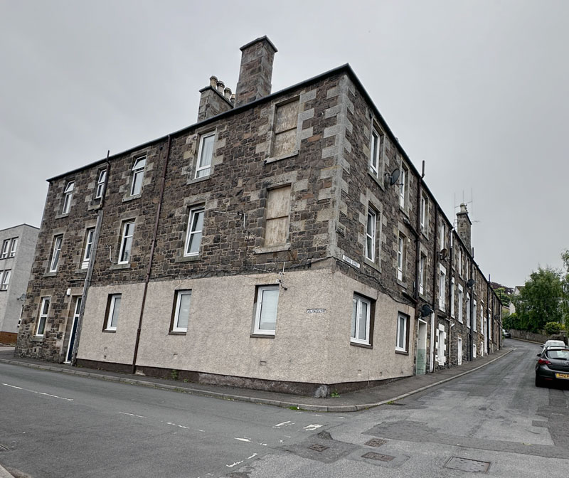
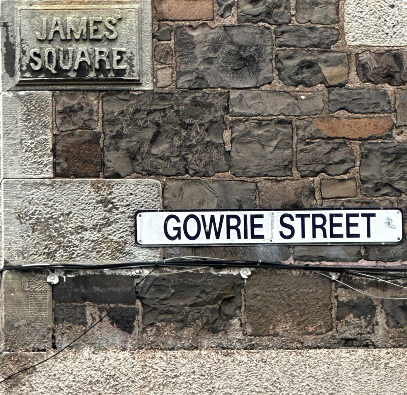
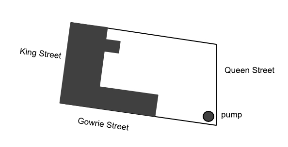
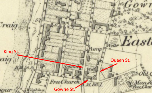
James’ Square is a block of 22 houses on the corner of King Steet, Gowrie Street and Queen Street.
It was built by the local builder James Brown who named it after himself.
Most of the houses were built in the 1860s and 1870s but the site has a longer story.
Early days – a house or not?
The plot was on the southeast corner of Marytown and was first feued by its owner William Berry of Tayfield to John Duncan, a boatman residing in Newport, on 2 November 1838. Duncan had to build a house there within 3 years or else the feu rights would be null and void.1
If Duncan built a house there, it was certainly short-lived. There is no building shown on the 1840 plan of part of Tayfield,2 nor is there one shown on the 1846 plan.3 The 1841 census, which is very difficult to use for locations in East Newport, does indeed have John Duncan and family living in Marytown4 in a location which could conceivably be this one, but it isn’t certain. However, what leads me to believe that there was a house is that the feu wasn’t declared null and void, and was sold to Alexander Rhind in August 1846.
Stage 2 – the bakery
Alexander Rhind, ‘an energetic man of business, he not only ran the farm at Woodhaven but had a bakery situated at the King Street corner now occupied by the James Square block of buildings’,5 bought the Gowrie Street plot in 1846 and lost no time in building substantial premises for a bakery business – described in 1848 as ‘that new bakehouse with 2 ovens, shop, stable and other premises, together with a range of lofts in the second storey of the buildings, as possessed by Alexander Rhind and his partners in the baking business carried on by them at Newport. The premises are quite new, are erected in a most substantial manner and altogether are of the most complete description’.6 The main part of the building was on King Street, opposite the Free Church, with a narrower wing running from the corner halfway up Gowrie Street. The backyard was open and there was a water pump on the corner of Gowrie Street and Queen Street.
At the same time he was acquiring the plot at the other end of King Street on which he was to build Seacraig House (see the blog Seacraig) described as ‘one of the best at Newport – no expense has been spared’.7
Did Rhind overreach himself? Well, he was declared bankrupt in 1848 but continued running the bakery business for a further 20 years. (Trustees for his family took ownership of the buildings as no buyer could be found.8) It was indeed a sizeable business. Alexander is described in the 1851 census as a master baker employing 4 men, 2 carters and 1 shopman, as well as being a corn merchant and storekeeper. Two of his bakers, John Dick and George Thomson, live in Rhind’s cottages in King Street and his shopman, John Rich, lives on the premises – at least he wouldn’t have to pay for his heating!9
Stage 3 – housing
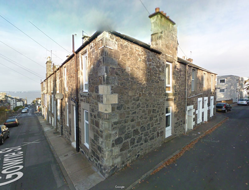
In 1868 when Alexander Rhind was in his 70s, the property was sold10 to James Brown, the builder of many of the houses in East Newport. He kept part of the bakery premises and let them out to another baker – William Hurry – but used the rest of the buildings as workshops and a wood store. He built the first houses on the empty part of the plot – along Queen Street and halfway down Gowrie Street (now 1-13 Queen Street and 25 & 27 Gowrie Street). Some were occupied by 1869.
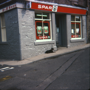
For the next few years Brown was busy elsewhere in Newport. In 1875 Mr Hurry moved out of the baker’s premises to a new bakery on Boat Road, and a grocer’s shop was opened here instead. It wasn’t until 1879-80 that Brown resumed building work here. He converted / rebuilt the property on the rest of Gowrie Street and along King Street. By 1881 they had all been converted to houses, the last ones to be finished were the bigger houses of 13, 15, 21 & 23 King Street.11 To finish the story, the shop closed and was converted to a house around 1990.
My connection to the Square? Well, my parents owned the corner shop in the 1970s and early 1980s; and Jimmy Simpson the painter and I decorated no. 15 for my Aunty Joan before she moved into it in the 1970s.
Sources:
- Sasine Abridgements, Fife 1846 00308
- Photocopy of plan of the south coast of the Tay along the estate of Tayfield, the property of William Berry, early 19th century, at the National Records of Scotland, ref. RHP30444 [from the buildings shown, this is c.1840]
- Photocopy of plan of part of estate of Tayfield as extending along the coast of the Tay, the property of William Berry, 1846, at the National Records of Scotland, ref. RHP30454
- Census 1841 Forgan parish, Fife, District 1, p 10, original at ScotlandsPeople
- Dundee Courier, 21 Nov 1911, p6 – obituary of Henry S Rhind (Alexander’s son) (all newspapers available at British Newspaper Archive)
- Fifeshire Journal, 24 Aug 1848, p1
- Fifeshire Journal, 24 Aug 1848, p1
- Dundee Courier, 6 Sep 1848, p1; Valuation Roll entries for bakehouse,etc, 1855-67
- Census 1851 Forgan parish, Fife, District 1 : Alexander Rhind, John Dick, George Thomson, John Rich
- Sasine Abridgements, Fife 1868 03144
- Directory and Valuation Roll entries for James Square and James’ Square (this entry for 23 Gowrie Street will provide links to the others)
Photos:
- Queen Street & Gowrie Street view – Google Streetview, 56.4405623, -2.9380348, October 2009
- Others – personal collection