
Maps
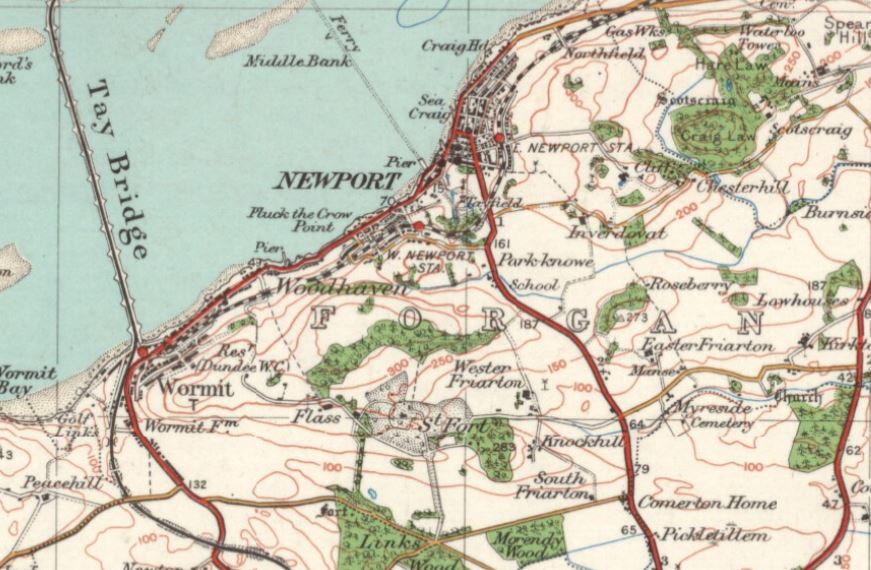
Ordnance Survey One-inch to the mile, Popular edition, Scotland, 1920-1930.
Reproduced with the permission of the National Library of Scotland National Library of Scotland
Quick Links:
- 1854 6-inches to the mile (1:10560), geo-referenced, or clearer copy, not geo-referenced at the National Library of Scotland (opens in a new tab / window)
- 1895 25-inches to the mile (1:2500), geo-referenced, at the National Library of Scotland (opens in a new tab / window)
- 1914 25-inches to the mile (1:2500), East Newport, at the National Library of Scotland (opens in a new tab / window)
- 1914 25-inches to the mile (1:2500), West Newport, at the National Library of Scotland (opens in a new tab / window)
- 1914 25-inches to the mile (1:2500), Wormit, at the National Library of Scotland (opens in a new tab / window)
- 1914 25-inches to the mile (1:2500), Wormit Farm / Newton, at the National Library of Scotland (opens in a new tab / window)
- 1914 25-inches to the mile (1:2500), area around the five-roads / St Fort, at the National Library of Scotland (opens in a new tab / window)
- 1914 25-inches to the mile (1:2500), area around old Forgan church, at the National Library of Scotland (opens in a new tab / window)
- 1914 25-inches to the mile (1:2500), area around Chesterhill, at the National Library of Scotland (opens in a new tab / window)
- 1944-50 aerial photograph, at the National Library of Scotland (opens in a new tab / window)
- 1952-61 1-inch to the mile (1:63360), geo-referenced, at the National Library of Scotland (opens in a new tab / window)
- 1960s 6-inches to the mile (1:10560), geo-referenced, at the National Library of Scotland (opens in a new tab / window)
- 1966-73 25-inches to the mile (1:2500), geo-referenced for all except the extreme west of Wormit & Newton, at the National Library of Scotland (opens in a new tab / window)
Maps on this site:
- Plan of Wormit 1889
- Forgan Parish boundary
- Newport burgh boundary
- Newport original burgh boundary proposals
- 19th-century feuing areas
- Plans of individual feus
- Properties map - all properties existing in 1974 and many older ones
- Forgan Kirkyard plan
- Vicarsford Cemetery Lair Plan also plan without red dots
- Maps of Newport & Wormit from the Dundee Directories 1903 - 1949
- Place Names & Old Places map
- Location of Wormit Bay Golf Course
- Index to maps for the Valuation Office Survey 1909
- Early Feus on Tayfield Estate
- Plan of part of Scotscraig (covering East Newport), John Hope 1769, - geo-referenced overlay
- Plan of Newport, John Steedman 1825, - geo-referenced overlay
- Railway Plans:
- Maps of the Ferry Pier Area, 1845 - 1966
Links to Maps on other Sites:
Aerial photos:
| NCAP - the National Collection of Aerial Photography | NCAP - the National Collection of Aerial Photography (part of Historic Environment Scotland) has a huge collection of aerial photos from around the world. There are several hundred views of Newport, Wormit & Forgan, taken at various dates from the 1940s, possibly even earlier. Keep enlarging the map to find the location of the centre of each photo. |
| Britain From Above | has a smaller collection, probably a sub-set of those on the NCAP site, and are not easily searched. |
Maps:
| National Library of Scotland map collection | The best site for Scottish maps.
|
| ScotlandsPeople |
Registration (free) is required. Maps are free to view and download. --> Search our records --> Maps and Plans --> Select County: Fife, Select Parish: Forgan; leave other selection boxes blank 8 plans are online at present:
|
| ScotlandsPlaces: Forgan page |
Amongst the lists of photographs are catalogue entries for maps and plans held by the National Archives of Scotland, Edinburgh. (If you 'Filter the Results' for 'NRS' only, you will get a listing of the maps & plans only: Filtered Results) Only 2 of the plans are online at present:
|
| Vision of Britain | Land Utilisation Maps (1930s), and others. |
| PastMap | Mapping showing the location of historical buildings and archaeological sites recorded by the Royal Commission on the Ancient and Historical Monuments of Scotland, Edinburgh. |
| Scotland's Land Information Service | The Registers of Scotland map of Scottish present-day land ownership. |